Cranbrook-to-Kimberley Rail Trail – July 1, 2013
A year ago, while we were driving between Cranbrook and Kimberley, all of a sudden we noticed a bike path paralleling the highway. Stephen had talked about riding it – he knew that it went all the way to Kimberley and was an old railway track. It is known as the North Star Rail Trail. So we skidded to a stop, and Stephen retrieved his bike from the car, and he pedalled happily to Kimberley. I, on the other hand, drove the car to Kimberley, where we connected, loaded up his bike, and carried on our way.
But Stephen was always a bit disappointed that he hadn’t started the ride at the beginning.
For today, he determined the precise coordinates of the beginning and end of the trail. I dropped him off at the starting point in Cranbrook and picked him up at the end in Kimberley. Then we headed back to Cranbrook and on to Fernie, where we spent the night.
For those who care, the coordinates of the Cranbrook end are N49 32.018 W115 45.260, and the coordinates of the Kimberley end are N49 40.514 W115 58.629 .
Here is the Google Earth view of his 26 km ride:

It was a steady climb. Here is his elevation profile:

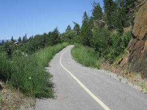
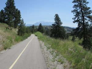
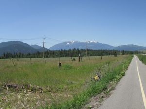
These are some photos that he took along the way.


He was a hot and tired biker by the time he got to Kimberley – it was 34 deg C according to the chariot!