Palm Springs, Jan 31, 2013 and Jan 31, 2017
Exactly 4 years apart, we again do the same trail. It really is comforting to go somewhere familiar.
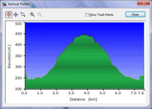
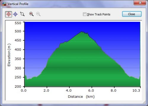
This is a more strenuous trail than we usually do. I have ranked it as Hard, because there are lengthy steep sections, lots of steps going up/down (hard on the knees), and many rocky trails. It’s also fairly lengthy – my trek was about 7.5 kms, and Stephen’s was just over 10 kms.
Map Information
We went to Indian Canyons (just south of Palm Springs), a really cool hiking area (lots of trails) on a local Indian reservation. We had to pay an admission to enter the area, but there are so many trails that it’s worth it to your typical hiker.
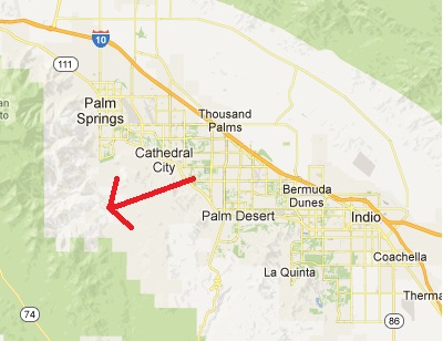
You’d think, based on the map, that you could get there by going due west of Palm Desert! Nope – you have to go right into Palm Springs and then go south!
Coordinates of the Parking Lot are: N33 44.276 W116 32.316
Between the two of us, we did two hikes. I did an out-and-back, and Stephen did a lollipop loop. We started off together, and then parted company after 3 kms at a junction of trails. He was able to walk much faster without me holding him back with my slow pace.
We had agreed to meet at the part where his loop rejoined the main trail. I got there about 10 minutes before he did – that tells you just how slowly I do the downhill parts!
So, where did we go? In these Google Earth shots, we started (and ended) at the top.
First my out-and-back track from 2013.
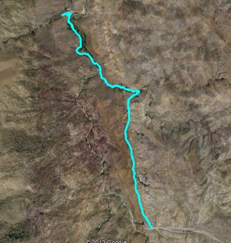
And my one-way from 2017 (my GPS ran out of battery on the return trip).

And Stephen’s lollipop loop from 2013.

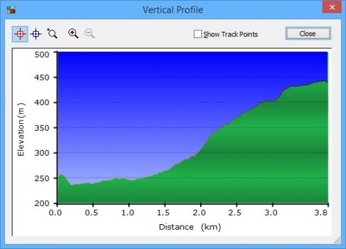
And the elevation profiles (and kilometers travelled).
First mine – the out-and-back one from 2013.
And my one-way one from 2017.
And Stephen’s loop from 2013.
The Trek
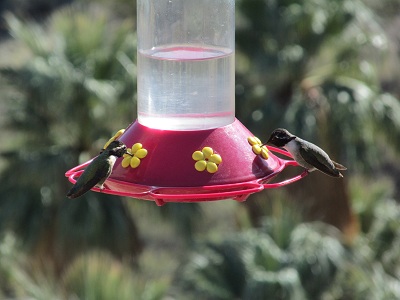
At the beginning of the hike, right by the Visitor Centre, there are some hummingbird feeders, along with some hummingbirds.
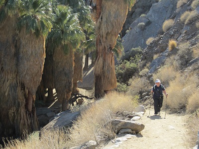
The first part of the trail is in a Palm Canyon (hence the name, I bet!).

In our 2017 trek, we came across a creek that needed to be forded. So off with our shoes and socks, and into the frigid water (there’s snow at the top of the nearby mountains). Here’s Stephen doing his thing:


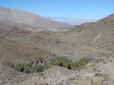
After a while, we left the canyon and climbed upwards. These shots show the canyon with its palms.

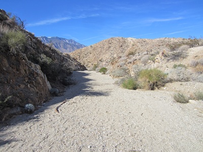
And this shot shows what the rest of the hike looked like – rocks and cacti and other desert plants. A lot of cholla! And Stephen off in the distance (he sure likes going faster than I go…)

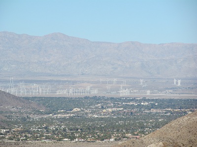
We could see a small portion of the wind farm north of Palm Springs.
And in 2017, we could see three distinct colors looking at the mountains: green closeup, brown further, and the snow-covered peaks in the distance.


After a couple of kilometers, we came to a major junction.

At this point, we decided to split up. Stephen took a longer loop, and I retraced my steps. We knew (based on our trip in 2011) that the trail he was going to take was pretty well unachievable by my knees – we had started it, and we had to give up at a bit of a wall that I just couldn’t climb.
Stephen took the path that would have him climbing down this wall (not up), and he had to slide down. This is the wall.

In general, though, the path that Stephen took was much easier walking than my return trip.

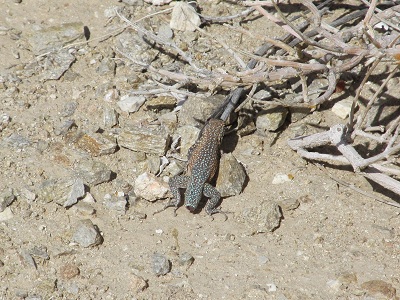
On my way back to the meeting point, I saw some wildlife.
First, a gecko that has lost its tail.
And a squirrel.

It is really disconcerting to see a sign like this one. But it is especially disconcerting to see it AFTER the hike has been completed!!

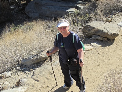
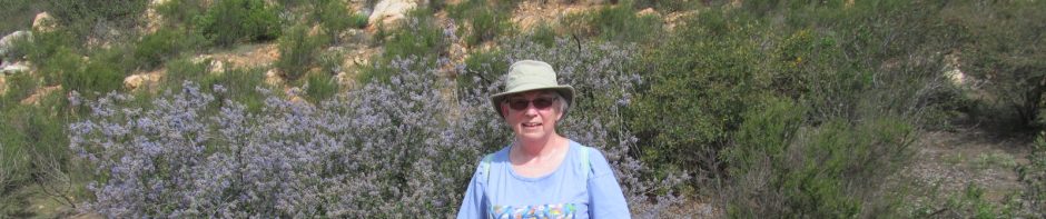
Here are the I-was-here photos. The first 2 are from 2013, the third from 2017.